
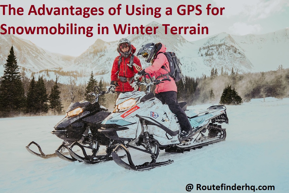
Are you planning a snowmobiling adventure this winter? With GPS, you can now enjoy the thrill of riding without worrying about getting lost in the snow-covered terrain.
In this guide, we’ll explore the advantages of using a GPS to make your snowmobiling experience safe and fun.
When snowmobiling in winter terrain, it is essential to have a GPS system that can provide you with the most recent and accurate information about your environment. A GPS not only helps you find your way around, but it also allows you to safely enjoy the outdoors by providing navigational assistance such as direction and an overview of any obstacles along the trail.

In addition, it can provide real-time updates on weather conditions, share local points of interest, and even provide hints on the best routes for reaching a destination. Furthermore, by using a GPS system while snowmobiling in unpredictable winter terrain, riders can be prepared for anything they might encounter while traversing through mountains or deep snow.
Ultimately, the use of a GPS system when snowmobiling in winter terrain has many advantages that provide riders with an enhanced experience both on-trail and off-trail.
Advantages of Using a GPS for Snowmobiling
Using a GPS for snowmobiling offers several advantages for navigating winter terrain. GPS receivers provide accurate direction and location information, allowing snowmobilers to stay on track and plan their routes accordingly. Furthermore, the mapping feature found in many devices can make it easier to visualize the terrain and observe any changes in elevation along the way. Furthermore, some modern GPS models can even be loaded with detailed maps of nearby ski resorts which feature helpful information like lift routes, trails, pistes and other amenities.
Another advantage of using a GPS is that it allows users to save their tracks so they can easily retrace their path if they get lost or simply want to explore an area again. This way, they don’t need to repeatedly set out on long trips just to find new routes – they can simply access previously saved maps with the push of a button. Lastly, some devices also come equipped with features like geolocation, weather information, trip log records and meters for speed and distance tracking. All these features combined make it possible for individuals to enjoy safe and enjoyable snowmobiling experiences in winter terrain.
Navigation
A GPS device provides snowmobilers with detailed map information, altitude and bearing to their destination. Knowing the correct route can save time and energy, as well as provide entertainment with the challenge of conquering new territory. With a GPS you can pinpoint your exact location and mark specific points-of-interest along your route for future reference or exploration.
As part of outfitting for snowmobiling in winter terrain, a manually operated paper map should be considered in addition to a GPS device. Although it may take longer to use than technology based information, paper maps provide durable and detailed back-up guidance when moving off the beaten path.
Mapping
Using a GPS for snowmobiling is a great way to get the most out of your winter excursions. A good GPS can provide detailed maps that provide directions, track your location and show you data, such as speed and elevation, that can help you navigate tricky terrain or find the best spot to fish.
Mapping is one of the biggest advantages of using a GPS. Generally, these devices come loaded with detailed maps of trails and regions in your area so you don’t have to worry about getting lost or finding yourself in unfamiliar areas. Your GPS can also give you approximate distances between two waypoints, which can be greatly beneficial if you want to plan ahead and prepare for the journey ahead. What’s more, some systems allow you to download satellite images or other detailed maps that may prove especially helpful during extreme weather conditions such as heavy fog or storms when visibility is limited.
Route planning
Route planning is one of the many advantages of using a GPS for snowmobiling in challenging winter terrain. With an up-to-date GPS device, you can quickly identify your current location and set a route to where you want to go. This eliminates the worries of getting lost in the more difficult snowmobile trails, as well as allowing you to navigate around any unexpected obstacles.
In addition, a GPS can give advanced warning of potential hazards on your route. Alerts notify you before reaching dangerous areas, such as steep inclines or icy patches, enabling you to prepare for these sections in advance and prevent accidents or disasters from occurring. Route planning also offers the advantage of seeing which routes are traveled most often by other riders and making informed decisions based on this information.
By also having access to preloaded trail maps and detailed topography, riders have plan specific routes with all necessary terrain data taken into account, giving them confidence in their navigation capabilities during winter rides. Furthermore these maps offer a range of other detailed details such as what services are available should an issue occur during the trip or safety information about particular areas where one must obey the law or take extra precautions when riding above a certain altitude.
Safety
When snowmobiling in unfamiliar winter terrain, it is important to be aware of the potential risks and take steps to ensure your safety. The use of a GPS can provide significant safety benefits by increasing awareness of your location and the potential hazards that could be present.
By setting waypoints or saving tracks, you can easily record the path that you took and later review this data to identify potential dangers that may have been overlooked. You can also refer to maps with geographical features to help ensure that you always stay on known trails and remain aware of your proximity to obstacles such as trees, rocks, or other structures.
Additionally, a GPS allows you to monitor the weather conditions in order to be prepared for sudden drops in temperature or changing snow conditions. This can help you stay safe while having fun outdoors during the winter months.
Emergency response
Using a GPS while snowmobiling in winter terrain has a number of advantages, chief among them the ability to provide emergency responders with your exact location and status. If you become lost or injured on the trail, key information like your coordinates, heading and speed will be instantly available for first responders. This can make a huge difference in search times and aid in successful recovery efforts.
Additionally, GPS routes can be pre-loaded into the system to help plan the best course of action for efficient navigation of the terrain.
Avalanche detection
One of the most important features of modern GPS units for snowmobiling is the avalanche detection technology. By allowing you to track your position and record any significant changes in depth or orientation that may be indicative of impending danger, you can stay one step ahead.
This technology uses a special antenna and incorporates measurements from both elevation and inclination to detect any potential signs of an avalanche strike. As well as providing an early warning to snowmobilers, this advanced feature also allows rescuers to locate victims more quickly if something goes wrong.
Furthermore, it can be used by professionals such as ski patrol teams and guides who are trained to assess risk levels in the mountain environment.
III. How to Use a GPS for Snowmobiling
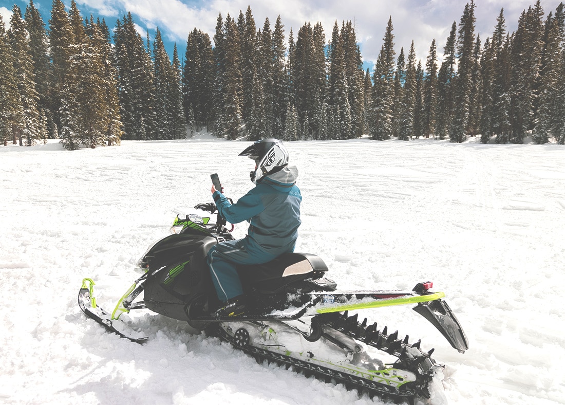
Using a GPS for snowmobiling can make your experience safer and more enjoyable. GPS provides advanced navigation features that can help you get from point A to point B in the shortest possible time. It also allows you to easily detect where you are and save any points you want to return back to.
To properly use a GPS for snowmobiling, first identify what areas you plan to ride in; many states provide maps or have websites that list areas for snowmobiling. Before starting your route, enter as much information about the trail as possible into your GPS. This will ensure accurate positioning throughout your journey.
Once out on the trails, it is important to periodically check your location to ensure that you are on track and following the correct route, as any deviations could lead to a dangerous situation such as getting stuck in snow drifts or lost due to wrong turns! If riding in an unfamiliar area, make sure someone else knows the exact route that you’re taking so they can come help if needed.
Finally, if unexpected weather conditions arise (blizzards or large amounts of snowfall), having a GPS with highway routes pre-programmed may help avoid potential disasters by enabling faster escapes!
Choosing the right device
When looking for the best GPS for snowmobiling, there are certain features to consider. The device should be easy to use, have a battery life that lasts the duration of your trip, and contain pre-loaded maps of the areas where you will be riding. In addition, it might be advantageous to select a model with an integrated camera so you can document your trip and share photos with others or store them in your own archives.
GPS devices that are specially designed for snowmobiles come with features specifically tailored to winter activities. They usually feature large color displays that are easier to view in low light conditions such as early morning or late evening rides when visibility can be limited by falling snow or heavy clouds. Plus many offer a Vibrant Glove Mode feature which provides audible navigation cues through gloves to provide better control of the vehicle at all times and reduce fatigue from having to constantly reference the device itself. Additionally, many also contain specific off-trail navigation capabilities such as plotting points on an aerial photo map as well as topographic maps providing 3D trail visualization of terrain ahead.
Understanding GPS features
GPS navigation devices come in many shapes and sizes, with different levels of user interface complexity and accuracy. Whether you choose a vehicle-mounted GPS or a handheld model, you should be familiar with the features available on your device.
Understanding some of the features of your GPS can make your snowmobiling journeys safer and easier. Here is an overview of some of the most common features:
- Waypoints – Waypoints are a virtual map for tracking your location and guiding you back to where you started. You can manually enter waypoints along the way or use pre-defined routes from other riders to get to certain points in winter terrain that only experienced riders know about.
- Contour Maps – This feature layers topographical data onto maps in order to help identify terrain elevation and view weather hazards ahead of time while planning trails in winter terrain.
- Satellite Imagery – Satellite imagery displays digital images taken by satellites above Earth in real time as they orbit around it, providing details such as foliage, open areas without trees, water features like rivers or streams, and other snowmobile points-of-interests on the trail map (such as cabins).
- 3D Navigation – Also known as augmented reality navigation systems, this feature combines GPS navigation with live video capture technology to show navigation trails overlaid onto real life scenes while riding through winter terrain so it’s easier to stay on track even if you become lost due to inclement weather like low visibility fog or whiteout conditions.
- POI (Points Of Interest) Database– A database containing places related specifically to activities related to snowmobiling when riding through winter terrain; these databases contain potential destinations where there may be fuel stops, places where repairs might be carried out, any rental services that may offer snowmobiles/gear etc., and more preferences based on trails/locations stored into the database before setting out on your journey.
Tips for effective use
In order for a GPS to be most effective in winter terrain, consider the following tips:
- Ensure batteries are fully charged as cold temperatures can significantly reduce a battery’s life. Lights and heated clothing draw power from the batteries, reducing its charge even further.
- Don’t rely entirely on a GPS for navigation. Use common sense and follow the trails where possible in order to avoid getting lost or stuck in deep snow.
- Beware of dead zones where satellites are blocked by trees, hills, or even snow cover that hide the signal from your device. Plan for back-up navigation as well as cell phone chargers to be sure of your location if needed during a ride.
- Be aware of coordinates and how to read them so you can accurately pinpoint yourself on a map should you need assistance from search-and-rescue teams if you get lost in an area with no cell service or signal coverage by satellite either due to obstruction or atmospheric conditions at higher altitudes.
- Rechargeable options are preferred over traditional disposable batteries when using electronic devices such as GPS units during longer trips so you don’t end up going without power at an inconvenient time due to exhausted energy levels in standard batteries that become unreliable below freezing temperatures.
Conclusion
In conclusion, a GPS device equipped with winter trail maps is the ideal way of navigating winter terrain when snowmobiling. It offers numerous advantages, including accuracy, trail navigation, ability to share locations and trails with friends, and real-time weather updates.
A GPS also allows you to feel comfortable and secure knowing that you won’t accidentally get lost or take a wrong turn while enjoying your ride. Choosing the right device for your need is important to ensure maximum enjoyment on your outing.
Before you hit the trails this winter, make sure you have the right gear to keep yourself safe and enjoy an unforgettable ride!
FAQ’s
What is the benefit of a snowmobile?
A snowmobile provides an efficient mode of transportation in snowy terrains, allowing access to remote areas and winter sports.
What is the Global Positioning System GPS snowmobile?
A GPS snowmobile is a snowmobile equipped with GPS technology, enabling riders to navigate through unfamiliar terrain and locate their position.
What are some important facts about the snowmobile?
Snowmobiles are powered by internal combustion engines and typically have a top speed of around 60 mph. They are commonly used for recreation, transportation, and search and rescue operations.
Why do people use snowmobiles?
People use snowmobiles for various reasons, including recreation, transportation in snowy areas, hunting, and emergency situations.
Why are snowmobiles good at snow?
Snowmobiles are designed with a wide track and specialized treads that provide traction and maneuverability in deep snow, making them ideal for snowy terrains.
What is the difference between a snowmobile and a snowmobile?
There seems to be a repetition in the question. There is no difference between a snowmobile and a snowmobile.
What is another name for a snowmobile?
Another name for a snowmobile is a sled or a snow machine.
What is a nickname for a snowmobile?
A nickname for a snowmobile is a “sled” or a “snowmachine.”
What is a 2 person snowmobile called?
A 2 person snowmobile is commonly referred to as a 2-up or a 2-seater snowmobile.
Can 3 people ride a snowmobile?
Some snowmobiles are designed to accommodate up to 3 people, but it is important to check the manufacturer’s recommendations for the maximum number of riders. It is not safe to overload a snowmobile.
See Also-
- Best trucker gps 2023
- Best gps for kayak 2023
- Best gps for hunting 2023
- Best gps for geocaching 2023
- Best gps for boat 2023